Antarctica
From Wikipedia, the free encyclopedia
Geography

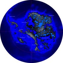
A satellite
composite image of Antarctica.
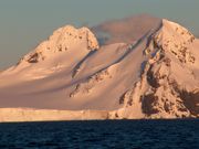
Maritime Antarctica.
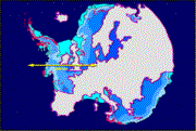
Size
comparison Europe-Antarctica.
Most of Antarctica is
located south of the Antarctic Circle, surrounded by the Southern Ocean. It is
the southernmost land mass and comprises more than 14 million km², making
it the fifth-largest continent. The coastline measures 17 968 km
(11,160 miles) and is mostly characterized by ice formations, as the
following table shows:
Coastal types around Antarctica
(Drewry, 1983)
Type
Frequency
Ice shelf
(floating ice front)
44%
Ice walls
(resting on ground)
38%
Ice
stream/outlet glacier (ice front or ice wall)
13%
Rock
5%
Total
100%
Physically, it is divided
in two by the Transantarctic Mountains close to the neck between the Ross Sea
and the Weddell Sea. The portion west of the Weddell Sea and east of the Ross
Sea is called Western Antarctica and the remainder Eastern Antarctica, because
they roughly correspond to the Western and Eastern Hemispheres relative to the Greenwich
meridian.
About 98% of Antarctica is
covered by the Antarctic ice sheet. The ice sheet is, on average,
2.5 kilometers (1.6 miles) thick. The continent has approximately 90%
of the world's ice (approximately 70% of the world's fresh water). If all of
this ice were melted sea levels would rise about 61 m (200 feet).[16] In most of the interior of the continent precipitation
is very low, down to 20 mm/yr; in a few "blue ice" areas
precipitation is lower than mass loss by sublimation and so the local mass
balance is negative. In the dry valleys the same effect occurs over a rock
base, leading to a desiccated landscape.
Western Antarctica is
covered by the West Antarctic Ice Sheet. The sheet has been of recent concern
because of the real, if small, possibility of its collapse. If the sheet were
to break down, ocean levels would rise by several meters in a relatively geologically
short period of time, perhaps a matter of centuries. Several Antarctic ice
streams, which account for about 10% of the ice sheet, flow to one of the many Antarctic
ice shelves.

Mt. Erebus,
an active volcano on Ross Island.
Vinson Massif, the highest
peak in Antarctica at 4892 meters (16,050 feet), is located in the Ellsworth
Mountains. Although Antarctica is home to many volcanoes, only Mount Erebus is
active. Mount Erebus, located in Ross Island, is the southernmost active
volcano. There was another famous volcano called Deception Island, which is
famous for its giant eruption in 1970. Minor eruptions are frequent and lava
flow has been observed in recent years. Other dormant volcanoes may potentially
be active.[17] In 2004, an underwater volcano was found
in the Antarctic Peninsula by American and Canadian researchers. Recent
evidence shows this unnamed volcano may be active.[18]
Antarctica is home to more
than 70 lakes that lie thousands of meters under the surface of the continental
ice sheet. Lake Vostok, discovered beneath Russia's Vostok Station in 1996, is
the largest of these subglacial lakes. It is believed that the lake has been
sealed off for 35 million years. There is some evidence that Vostok's waters
may contain microbial life. The sealed, frozen surface of the lake shares
similarities with Jupiter's moon Europa. Confirming that life can survive in
Lake Vostok strengthens the argument for life on the satellite.[19][20]
Geology
Geological
history and paleontology
More than 170 million years
ago, Antarctica was part of the supercontinent Gondwana. Over time Gondwana
broke apart and Antarctica as we know it today was formed around 25 million
years ago.
Paleozoic era
(540-250 Mya)
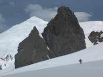
Survey
route.
During the Cambrian period
Gondwana had a mild climate. West Antarctica was partially in the northern
hemisphere, and during this period large amounts of sandstones, limestones and shales
were deposited. East Antarctica was at the equator, where sea-floor invertebrates
and trilobites flourished in the tropical seas. By the start of the Devonian
period (416 Mya) Gondwana was in more southern latitudes and the climate was
cooler, though fossils of land plants are known from this time. Sand and silts
were laid down in what is now the Ellsworth, Horlick and Pensacola Mountains. Glaciation
began at the end of the Devonian period (360 Mya) as Gondwana became centered
around the South Pole and the climate cooled, though flora remained. During the
Permian period the plant life became dominated by fern-like plants such as Glossopteris,
which grew in swamps. Over time these swamps became deposits of coal in the Transantarctic
Mountains. Towards the end of the Permian period, continued warming led to a
dry, hot climate over much of Gondwana.[21]
Mesozoic era (250-65 Mya)
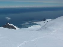
Bransfield
Strait.
As a result of continued
warming, the polar ice caps melted and much of Gondwana became a desert. In
East Antarctica the seed fern became established, and large amounts of
sandstone and shale were laid down at this time. The Antarctic Peninsula began
to form during the Jurassic period (206-146 Mya), and islands gradually rose
out of the ocean. Ginkgo trees and cycads were plentiful during this period, as
were reptiles such as Lystrosaurus. In West Antarctica conifer forests
dominated through the entire Cretaceous period (146-65 Mya), though Southern
beech began to take over at the end of this period. Ammonites were common in
the seas around Antarctica, and dinosaurs were also present, though only two
Antarctic dinosaur species (Cryolophosaurus from the Hanson Formation
and Antarctopelta) have been described to date. It was during this
period that Gondwana began to break up.
Gondwana breakup (160-23 Mya)
Africa separated from
Antarctica around 160 Mya, followed by India in the early Cretaceous (about 125
Mya). About 65 Mya, Antarctica (then connected to Australia) still had a
tropical to subtropical climate, complete with a marsupial fauna. About 40 Mya Australia-New
Guinea separated from Antarctica and the first ice began to appear. Around 23
Mya, the Drake Passage opened between Antarctica and South America resulted in
the Antarctic Circumpolar Current. The ice spread, replacing the forests that
then covered the continent. Since about 15 Mya, the continent has been mostly
covered with ice.[22]
Geology
of present-day Antarctica
Antarctica
without its ice-shield. This map does not consider that sea level would rise
because of the melted ice, nor that the landmass would rise by several hundred
meters over a few tens of thousands of years after the weight of the ice was no
longer depressing the landmass.
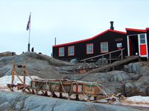
Port
Lockroy Museum.
The geological study of
Antarctica has been greatly hindered by the fact that nearly all of the
continent is permanently covered with a thick layer of ice. However, new
techniques such as remote sensing have begun to reveal the structures beneath
the ice.
Geologically, West
Antarctica closely resembles the Andes of South America.[21] The Antarctic Peninsula was formed by uplift
and metamorphism of sea-bed sediments during the late Paleozoic and the early
Mesozoic eras. This sediment uplift was accompanied by igneous intrusions and volcanism.
The most common rocks in West Antarctica are andesite and rhyolite volcanics
formed during the Jurassic Period. There is also evidence of volcanic activity,
even after the ice sheet had formed, in Marie Byrd Land and Alexander Island. The
only anomalous area of West Antarctica is the Ellsworth Mountains region, where
the stratigraphy is more similar to the eastern part of the continent.
East Antarctica is
geologically very old, dating from the Precambrian era, with some rocks formed
more than 3 billion years ago. It is composed of a metamorphic and igneous
platform which is the basis of the continental shield. On top of this base are
various more modern rocks, such as sandstones, limestones, coal and shales laid
down during the Devonian and Jurassic periods to form the Transantarctic Mountains.
In coastal areas such as Shackleton Range and Victoria Land some faulting has
occurred.
The main mineral resource
known on the continent is coal.[22] It was first
recorded near the Beardmore Glacier by Frank Wild on the Nimrod Expedition, and
now low-grade coal is known across many parts of the Transantarctic Mountains. The
Prince Charles Mountains contain significant deposits of iron ore. The most
valuable resources of Antarctica lie offshore, namely the oil and natural gas
fields found in the Ross Sea in 1973. Exploitation of all mineral resources is
banned until 2048 by the Protocol on Environmental Protection to the Antarctic
Treaty.
Wikipedia
http://en.wikipedia.org/w/index.php?title=Antarctica&action=history
Geography
A satellite
composite image of Antarctica.
Maritime Antarctica.
Size
comparison Europe-Antarctica.
Most of Antarctica is
located south of the Antarctic Circle, surrounded by the Southern Ocean. It is
the southernmost land mass and comprises more than 14 million km², making
it the fifth-largest continent. The coastline measures 17 968 km
(11,160 miles) and is mostly characterized by ice formations, as the
following table shows:
|
Coastal types around Antarctica
(Drewry, 1983) |
|
|
Type |
Frequency |
|
Ice shelf
(floating ice front) |
44% |
|
Ice walls
(resting on ground) |
38% |
|
Ice
stream/outlet glacier (ice front or ice wall) |
13% |
|
Rock |
5% |
|
Total |
100% |
Physically, it is divided
in two by the Transantarctic Mountains close to the neck between the Ross Sea
and the Weddell Sea. The portion west of the Weddell Sea and east of the Ross
Sea is called Western Antarctica and the remainder Eastern Antarctica, because
they roughly correspond to the Western and Eastern Hemispheres relative to the Greenwich
meridian.
About 98% of Antarctica is
covered by the Antarctic ice sheet. The ice sheet is, on average,
2.5 kilometers (1.6 miles) thick. The continent has approximately 90%
of the world's ice (approximately 70% of the world's fresh water). If all of
this ice were melted sea levels would rise about 61 m (200 feet).[16] In most of the interior of the continent precipitation
is very low, down to 20 mm/yr; in a few "blue ice" areas
precipitation is lower than mass loss by sublimation and so the local mass
balance is negative. In the dry valleys the same effect occurs over a rock
base, leading to a desiccated landscape.
Western Antarctica is
covered by the West Antarctic Ice Sheet. The sheet has been of recent concern
because of the real, if small, possibility of its collapse. If the sheet were
to break down, ocean levels would rise by several meters in a relatively geologically
short period of time, perhaps a matter of centuries. Several Antarctic ice
streams, which account for about 10% of the ice sheet, flow to one of the many Antarctic
ice shelves.
Mt. Erebus,
an active volcano on Ross Island.
Vinson Massif, the highest
peak in Antarctica at 4892 meters (16,050 feet), is located in the Ellsworth
Mountains. Although Antarctica is home to many volcanoes, only Mount Erebus is
active. Mount Erebus, located in Ross Island, is the southernmost active
volcano. There was another famous volcano called Deception Island, which is
famous for its giant eruption in 1970. Minor eruptions are frequent and lava
flow has been observed in recent years. Other dormant volcanoes may potentially
be active.[17] In 2004, an underwater volcano was found
in the Antarctic Peninsula by American and Canadian researchers. Recent
evidence shows this unnamed volcano may be active.[18]
Antarctica is home to more
than 70 lakes that lie thousands of meters under the surface of the continental
ice sheet. Lake Vostok, discovered beneath Russia's Vostok Station in 1996, is
the largest of these subglacial lakes. It is believed that the lake has been
sealed off for 35 million years. There is some evidence that Vostok's waters
may contain microbial life. The sealed, frozen surface of the lake shares
similarities with Jupiter's moon Europa. Confirming that life can survive in
Lake Vostok strengthens the argument for life on the satellite.[19][20]
Geology
Geological
history and paleontology
More than 170 million years
ago, Antarctica was part of the supercontinent Gondwana. Over time Gondwana
broke apart and Antarctica as we know it today was formed around 25 million
years ago.
Paleozoic era
(540-250 Mya)
|
Survey
route.
During the Cambrian period
Gondwana had a mild climate. West Antarctica was partially in the northern
hemisphere, and during this period large amounts of sandstones, limestones and shales
were deposited. East Antarctica was at the equator, where sea-floor invertebrates
and trilobites flourished in the tropical seas. By the start of the Devonian
period (416 Mya) Gondwana was in more southern latitudes and the climate was
cooler, though fossils of land plants are known from this time. Sand and silts
were laid down in what is now the Ellsworth, Horlick and Pensacola Mountains. Glaciation
began at the end of the Devonian period (360 Mya) as Gondwana became centered
around the South Pole and the climate cooled, though flora remained. During the
Permian period the plant life became dominated by fern-like plants such as Glossopteris,
which grew in swamps. Over time these swamps became deposits of coal in the Transantarctic
Mountains. Towards the end of the Permian period, continued warming led to a
dry, hot climate over much of Gondwana.[21]
Mesozoic era (250-65 Mya)
|
Bransfield
Strait.
As a result of continued
warming, the polar ice caps melted and much of Gondwana became a desert. In
East Antarctica the seed fern became established, and large amounts of
sandstone and shale were laid down at this time. The Antarctic Peninsula began
to form during the Jurassic period (206-146 Mya), and islands gradually rose
out of the ocean. Ginkgo trees and cycads were plentiful during this period, as
were reptiles such as Lystrosaurus. In West Antarctica conifer forests
dominated through the entire Cretaceous period (146-65 Mya), though Southern
beech began to take over at the end of this period. Ammonites were common in
the seas around Antarctica, and dinosaurs were also present, though only two
Antarctic dinosaur species (Cryolophosaurus from the Hanson Formation
and Antarctopelta) have been described to date. It was during this
period that Gondwana began to break up.
Gondwana breakup (160-23 Mya)
|
Africa separated from
Antarctica around 160 Mya, followed by India in the early Cretaceous (about 125
Mya). About 65 Mya, Antarctica (then connected to Australia) still had a
tropical to subtropical climate, complete with a marsupial fauna. About 40 Mya Australia-New
Guinea separated from Antarctica and the first ice began to appear. Around 23
Mya, the Drake Passage opened between Antarctica and South America resulted in
the Antarctic Circumpolar Current. The ice spread, replacing the forests that
then covered the continent. Since about 15 Mya, the continent has been mostly
covered with ice.[22]
Geology
of present-day Antarctica
Antarctica
without its ice-shield. This map does not consider that sea level would rise
because of the melted ice, nor that the landmass would rise by several hundred
meters over a few tens of thousands of years after the weight of the ice was no
longer depressing the landmass.
Port
Lockroy Museum.
The geological study of
Antarctica has been greatly hindered by the fact that nearly all of the
continent is permanently covered with a thick layer of ice. However, new
techniques such as remote sensing have begun to reveal the structures beneath
the ice.
Geologically, West
Antarctica closely resembles the Andes of South America.[21] The Antarctic Peninsula was formed by uplift
and metamorphism of sea-bed sediments during the late Paleozoic and the early
Mesozoic eras. This sediment uplift was accompanied by igneous intrusions and volcanism.
The most common rocks in West Antarctica are andesite and rhyolite volcanics
formed during the Jurassic Period. There is also evidence of volcanic activity,
even after the ice sheet had formed, in Marie Byrd Land and Alexander Island. The
only anomalous area of West Antarctica is the Ellsworth Mountains region, where
the stratigraphy is more similar to the eastern part of the continent.
East Antarctica is
geologically very old, dating from the Precambrian era, with some rocks formed
more than 3 billion years ago. It is composed of a metamorphic and igneous
platform which is the basis of the continental shield. On top of this base are
various more modern rocks, such as sandstones, limestones, coal and shales laid
down during the Devonian and Jurassic periods to form the Transantarctic Mountains.
In coastal areas such as Shackleton Range and Victoria Land some faulting has
occurred.
The main mineral resource
known on the continent is coal.[22] It was first
recorded near the Beardmore Glacier by Frank Wild on the Nimrod Expedition, and
now low-grade coal is known across many parts of the Transantarctic Mountains. The
Prince Charles Mountains contain significant deposits of iron ore. The most
valuable resources of Antarctica lie offshore, namely the oil and natural gas
fields found in the Ross Sea in 1973. Exploitation of all mineral resources is
banned until 2048 by the Protocol on Environmental Protection to the Antarctic
Treaty.